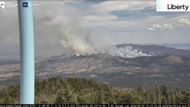
UPDATE: 3:55PM: Firefighters continue to battle the Hawk Fire on Sunday afternoon northwest of Reno, which has consumed 15,039 acres with zero percent containment as of last report and has forced the evacuation of thousands.
Approximately 90,000 residents are within the GET-SET and GO-NOW evacuation zones. Incident command advises people to not call 911 for evacuation information. Keep 911 and emergency dispatch lines available for those experiencing an emergency.
Firefighting personnel, at least 400, have been assigned from across the region from Carson City, Lake Tahoe, Lyon, Douglas and Storey counties, joining a unified command from Truckee Meadows Fire Protection District, Reno Fire Department and the U.S. Forest Service in battling the fire, along with air tanker and helicopter support from CalFire and Nevada National Guard.
Multiple air tankers and helicopters continue to work the western edge of the fire, including 2 super scoopers. Additionally some interior pockets are continuing to burn near Peavine Peak, according to Watch Duty.
Go here for the latest evacuation maps and and here for fire updates via WatchDuty.org. There’s no official word yet on structures damaged or lost. The fire is human caused and under investigation. U.S. 395 is currently closed in both directions from Parr Boulevard to Red Rock Road as of Sunday.
The fire started late Saturday morning and experienced significant growth throughout the day and into the overnight, fueled by strong, gusty winds, low humidity and dry vegetation. Firefighters continue working to protect communities, structures and critical infrastructure, according to Truckee Meadows Fire Protection District.
NV Energy reports more than 10,000 customers are without power in the fire zone area as of Sunday afternoon.
School Closures
All Washoe County School District schools, with the exception of Gerlach K-12 School, will be closed Monday, August 24.
 Evacuation Center:
Reno-Sparks Convention Center, Hall 4
4590 S. Virginia Street
Access the evacuation center from Kietzke Lane and enter through Door 20F on the Kietzke Lane side.

Meanwhile, Nevada Gov. Joe Lombardo declared a state of emergency in Washoe County on Saturday evening as the Hawk fire spreads rapidly and evacuation orders expand.
“I have declared a state of emergency in Washoe County as we respond to the Hawk Fire, which is spreading quickly and threatening homes and structures,” said Lombardo. “Please heed all warnings from local officials, evacuate immediately if you are ordered to do so, and do not put yourself or first responders at risk.”
Under the declaration, all state agencies are directed to work through the Nevada Emergency Operations Center to supplement local efforts.
“This is an active and rapidly evolving situation, and I urge everyone in the affected areas to remain vigilant and follow the direction of local officials,” Lombardo said. “The state is fully engaged, and we are working alongside local authorities and first responders to deploy every available resource to protect lives, safeguard communities, and keep Nevadans out of harm’s way.”

Evacuation Centers
As the community continues to be impacted by wildfires, the Washoe County Sheriff’s Office advises people to remain alert as emergency response efforts continue. Monitor official channels for the most up-to-date information, as conditions can change quickly.
Evacuation Center:
Reno-Sparks Convention Center, Hall 4
4590 S. Virginia Street
Access the evacuation center from Kietzke Lane and enter through Door 20F on the Kietzke side.
Small Animal Evacuations:
Please do not bring pets to the evacuation center. Small animals can be taken to:
Washoe County Regional Animal Services
2825 Longley Lane
Large Animal Evacuations:
Ironwood Event Center
5600 Whiskey Springs Road
Turn right into the second driveway. Please check in at the main office. Please drive slowly and safely.
Evacuation Information:
Please do not call 911 for evacuation information. Keep 911 and emergency dispatch lines available for those experiencing an emergency.
For current evacuation zones, warnings and road closures, visit:
RED: Evacuation Zone — Leave now
YELLOW: Evacuation Warning — Be prepared to leave
Emergency Updates:
For the latest emergency information and updates, visit:
NV Energy Outages:
For current outage information and preparedness resources, visit:
https://www.nvenergy.com/outages-and…/view-current-outages
For emergencies, always call 911.
Road Closures
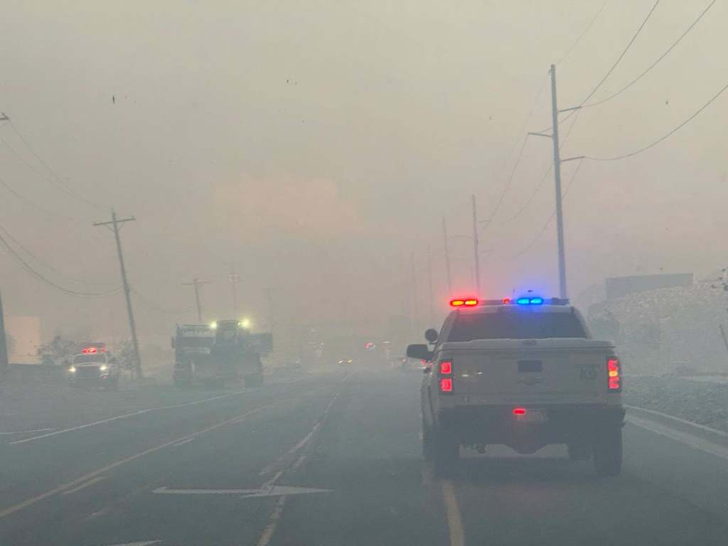
The Washoe County Sheriff’s Office on Sunday released the following information regarding road closures. US 395 Traffic Information:
• Northbound US 395 is closed from Parr Boulevard to Red Rock Road.
• Southbound US 395 traffic at Bordertown is being turned around before reaching White Lake.
• Southbound US 395 remains open from Red Rock Road south into Reno.
Current Road Closures:
• US 395 at Bordertown
• US 395 at Village Parkway
• US 395 at White Lake Parkway
• North Virginia Street at White Lake Parkway
• Northbound US 395 at Red Rock Road
• Southbound US 395 at Stead Boulevard
• Stead Boulevard at Matthews Street
• North Virginia Street at Panther Drive
• North Virginia Street at Parr Boulevard
• North Virginia Street at East Golden Valley Road
• Mae Anne Avenue at Somersett Parkway
• Del Webb Parkway at Somersett Parkway
• Robb Drive at Los Brisas Boulevard
• Lemmon Valley Drive at North Virginia Street
• Golden Vista Avenue at North Hills Boulevard
• East Golden Valley Road at Beckwourth Drive
• Red Rock Road at North Virginia Street
• Stead Boulevard at North Virginia Street
• Sharlands Avenue at Mae Anne Avenue
• Beaumont Parkway at Avenida de Landa
Monitor PerimeterMap.com for the most current evacuation information, road closures and changing conditions.
Additional Evacuation Resources
University of Nevada, Reno Extension’s Living With Fire Program reminds those who may be affected to consult its online evacuation resources, including the Wildfire Evacuation Checklist, to get prepared now. The Checklist is also available in Spanish.
Residents should follow the instructions of firefighters and emergency responders and to evacuate immediately when asked to do so.
How to Help
Want to help those impacted by the Hawk Fire? Go to:
https://www.emergencywashoe.com/fire/7135/
We will update as information becomes available.