Heading into Sunday afternoon and Memorial Day on Monday around Carson City and surrounding counties, warmer than average temperatures will continue with showers and thunderstorms expected in the afternoons and gusty winds possible, according to the National Weather Service.
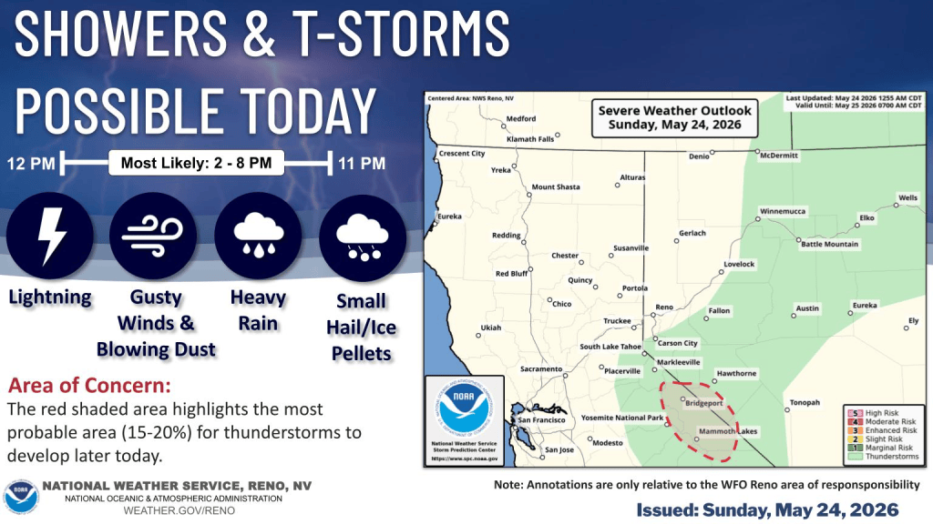
Forecasters say chances of thunderstorms Sunday will be more southern. Will they reach into Douglas County, Lyon County and Carson City? You never know what the weather will bring, but further south, in Mineral County and Mono County along the Highway 395 corridor, there’s a chance for windy conditions and thunderstorms that may bring choppy lake waters, blowing dust over desert sinks and small hail, NWS forecasters said.
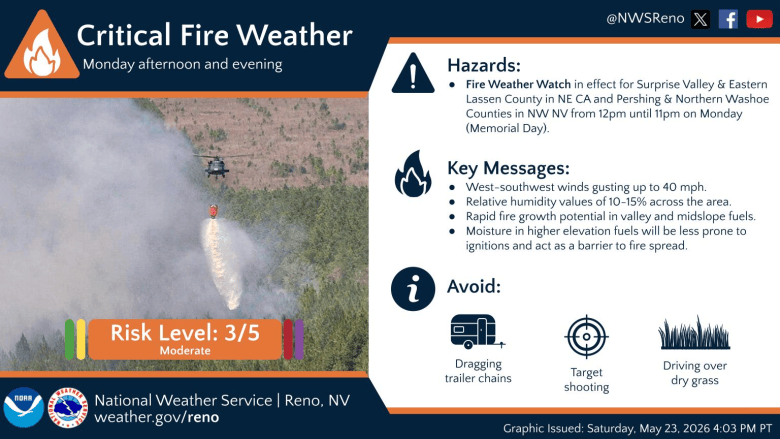
Monday will be our last day of warm weather, along with shower chances, mostly south into Mono County. Elsewhere, to the north, gusty westerly winds will be on the increase Monday afternoon. The higher gusts will be found across northern Washoe and Lassen counties into Surprise Valley in Modoc County. Gusts of up to 45 mph are possible for these areas, prompting the issuance of a Fire Weather Watch.
There are no watches or advisories at the time of this writing for Carson City, Carson Valley and Lyon County.
Further north, across Pershing County, gusts of up to 40 mph are more likely, as the bulk of the winds will be found along the Oregon border. This, along with poor overnight relative humidity recoveries.
Much cooler with mountain snow
Those winds will signal the incoming cold core closed low that will drop in from colder Canadian air and drop our temperatures back into mid April territory. This will be about 5 degrees below seasonal average by Wednesday, when widespread shower chances arrive.
The low will draw down cold air that will bring snow levels toward 7,000 to 7,500 feet by Wednesday morning. This will introduce snow chances for our higher peaks, although amounts look on the light side of accumulations, with only 1-2 inches for peaks around the Tahoe Basin, and 2 to 6 inches along the Sierra Crest in Mono and southern Alpine counties, NWS forecasters said.
Given that this closed low is slow to move out, shower chances, chilly temperatures and gusty to breezy wind will be our flavor of the week through Friday with a warmup looking probable for next weekend, NWS forecasters said.