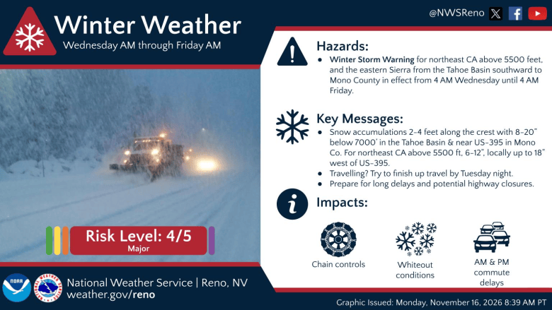
Following a brief break in the weather Tuesday, a strong winter storm is expected to affect Carson City and surrounding counties from Wednesday through early Friday, according to the National Weather Service in Reno.
For lower valleys Wednesday and Thursday, there’s a 60 to 80 percent chance for 1-2 inches of snow, with some weather models suggesting up to 3 inches, while the foothills will see between 4 to 8 inches. At least a foot of snow is expected for the Lake Tahoe Basin with up to 4 feet along the Sierra crest, NWS forecasters said.
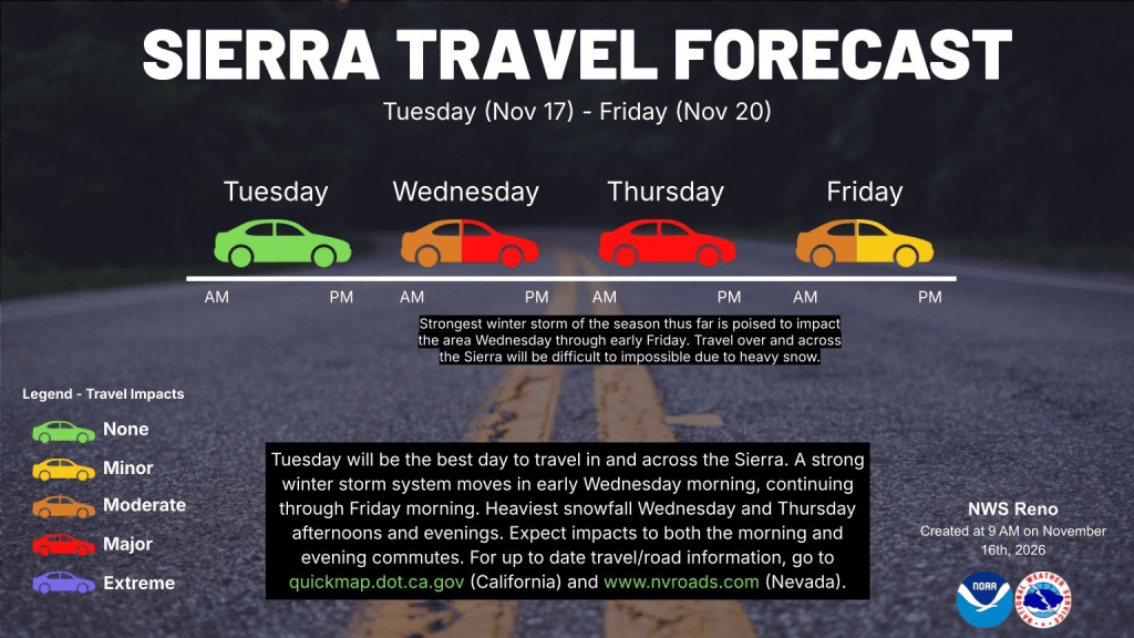
Sierra snow could start as early as sunrise Wednesday morning and continue into early Friday morning. Expect heavy snowfall rates at times with gusty winds producing periods of whiteout conditions, especially on Wednesday. Significant travel disruptions are likely across the Sierra and higher elevation roads. See NVroads.com for the latest travel updates.
Snow Wednesday through Thursday night
The winter storm will deliver heavy snow and gusty winds starting Wednesday morning in northeast California, spreading into the Lake Tahoe Basin and then into western Nevada by Wednesday afternoon, NWS forecasters said. Rounds of rain and snow will continue through Thursday night before tapering off early Friday.
Valleys winds will gust over 35 mph on Wednesday. Valley floors have a 60-80 percent chance for 1-2 inches of snow, with some recent models suggesting up to 3 inches over leeside valleys, such as Washoe Valley. Foothills could see snow amounts ranging 4-8 inches. Snow levels on Thursday will tumble to 4,500 to 5,000 feet, which could impact both the Thursday morning and Thursday evening commutes.
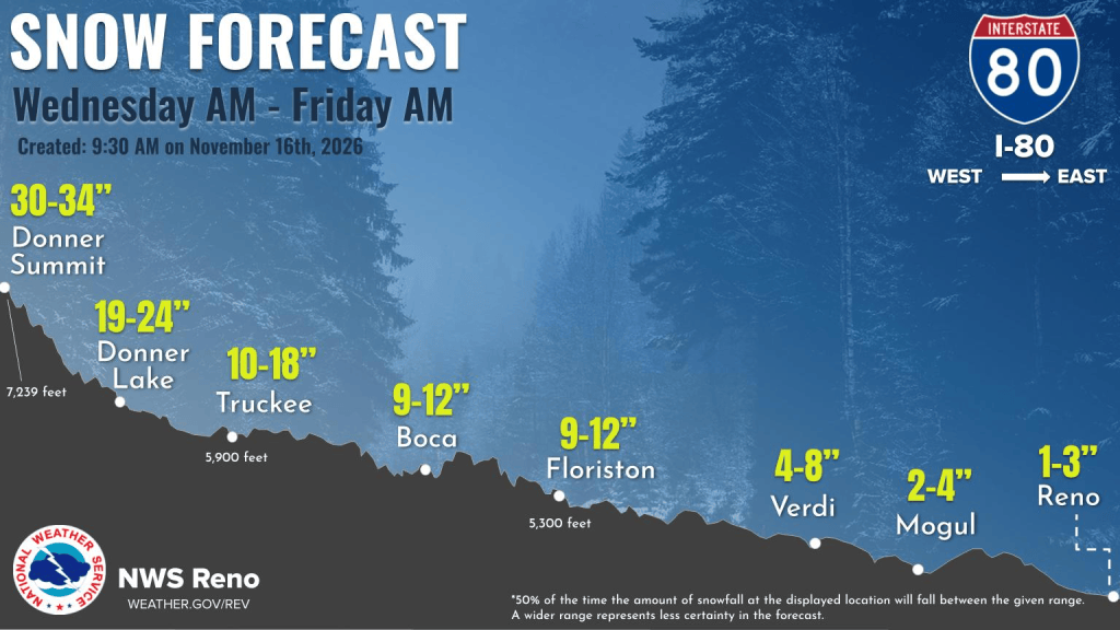
A Winter Storm Warning is in effect from Wednesday morning through early Friday for Lake Tahoe and the Sierra. National Weather Service guidance models show 100 percent probabilities of 12 inches of snow for the Sierra, with amounts of 3 to 4 feet along the crest. Sierra ridge gusts of up to 100 mph will produce whiteout conditions at times, NWS forecasters said.
Friday and into the weekend
Friday stays chilly with highs around 15 degrees below average. Lingering snow showers will persist through early Friday along the northern Sierra and out over the central Nevada Basin and Range, NWS forecasters said. The storm door remains open as another storm takes shape for late Saturday into Sunday brings light snowfall.
“This will land around the Thanksgiving travel window, so this is an early heads up on potential for travel disruptions,” according to the weather service.