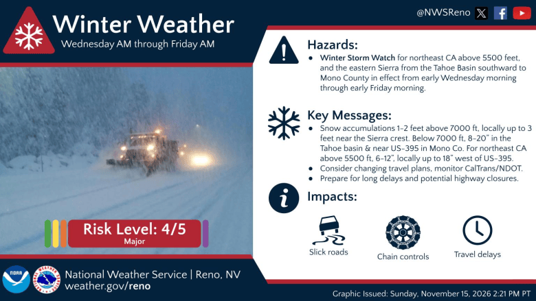
With valley rain and mountain snow continuing Monday, a much larger storm system will move into Carson City and surrounding counties midweek, with snow levels expected to drop to the valley floors and feet of snow around Lake Tahoe and Sierra, according to the National Weather Service.
A Winter Weather Advisory is in effect Monday for the Lake Tahoe Basin above 7,000 feet.
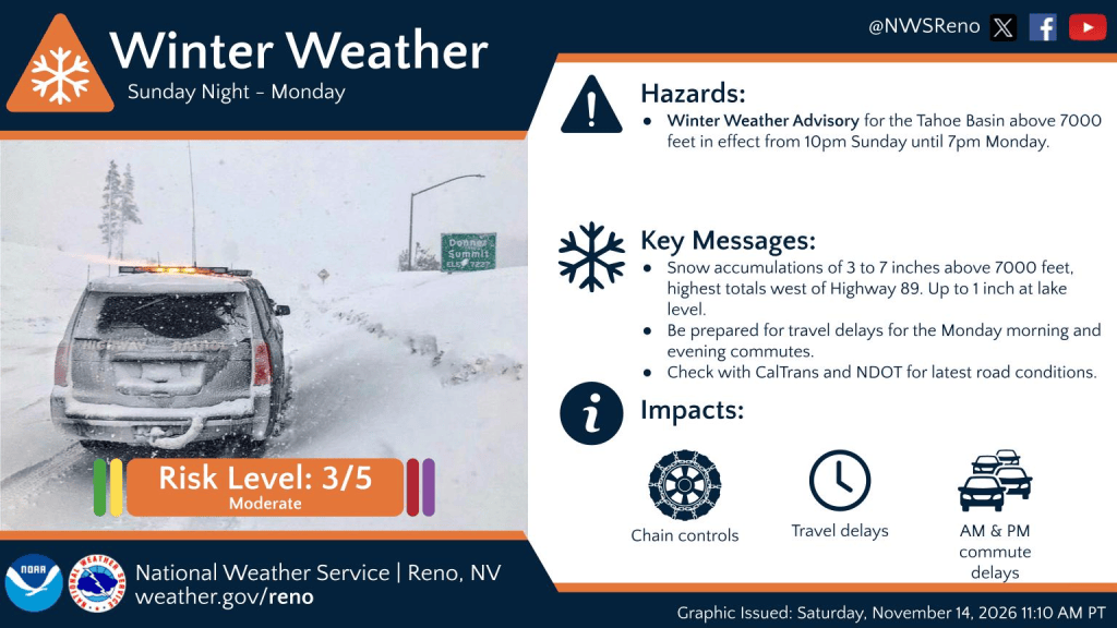
Light snow may mix down to 5,500 feet Monday night, with little to no accumulation expected. Higher passes in Mineral and Lyon counties may see 1 to 2 inches of wet, slushy snow tonight. For the Sierra, snow amounts will range 3 to 8 inches through the end of the event.
Tuesday will provide some respite in between storms with the main impact arriving Wednesday, with heavy mountain snowfall, NWS forecasters said. Dry conditions will hold through Tuesday night, offering a travel window before the next system arrives.
Ridgetop winds increase late Tuesday with gusts to 70+ mph. Western Nevada valleys may see Wednesday morning wind gusts of 25 mph to 35 mph. Gusty winds may bring periods of whiteout conditions and likely significant travel disruptions across the Sierra and higher elevation roadways, according to the weather service.
Valley snow, up to 4 feet in high Sierra Wednesday and Thursday
A brief period of snow could impact the Wednesday morning commute around Reno, Carson City and Carson Valley before south winds push snow levels up to 5,500 to 6,000 feet, NWS forecasters said.
On Thursday, snow levels fall to around 4,500 to 5,000 feet as winds become northerly, with snow showers potentially lingering into Thursday night. At the time of this writing, snow accumulation for the valleys could be less than two inches.
For the Sierra, this stronger, colder storm will bring heavy snow and high winds. A Winter Storm Watch is in effect Wednesday through Thursday night for northeast California above 5,500 feet, the Lake Tahoe Basin and Mono County. Higher eastern Sierra peaks could see up to 3 feet of snow, with western Sierra slopes and peaks seeing the highest totals up to 4 feet.
See NVroads.com for the latest travel information.
Chilly Friday, storm potential later in weekend
Friday will be chilly with lingering snow showers and temperatures 10-15 degrees below seasonal average. After a break early in the weekend, a fast-moving system is expected late Saturday into Sunday.
Active weather likely continues into Thanksgiving week, increasing the potential for holiday travel disruptions, NWS forecaster said.
Check back for updates.